Hi there! Welcome.
My name is Chinmay. I am a water resources scientist and a geospatial specialist with a passion for using technology and data-driven insights to solve multi-disciplinary, 21st-century challenges.
I lead the Water Security Thematic area at the SERVIR Science Coordination Office. SERVIR is a joint NASA and USAID partnership that harnesses the power of satellite data and science collaboration to support locally led efforts to strengthen climate resilience. Within the Water Security Thematic Area, we utilize Earth observation-driven services and capacity-building initiatives to help partners enhance sustainable access to freshwater and promote cooperation over shared water resources. I am particularly passionate about translating science into actionable insights to support environmental decision-making.
I hold a PhD in Water Resources Engineering from the University of Idaho. As a part of Dr. Erin Brooks' research group, my work focused on improving the understanding of the implications of various land management strategies on water quality. By employing advanced hydrology and water resources models, along with extensive geospatial datasets, I developed data-driven tools to inform stakeholders’ strategies in addressing climate risks and guiding environmental decision-making.
Previously, I had the privilege of being a Utrecht Excellence Scholar at Utrecht University in the Netherlands. During this time, I worked extensively with the PCR-GLOBWB model, a state-of-the-art global hydrology and water resources model. By integrating earth observation data and applying innovative approaches, my work focused on deriving critical water management insights in regions facing severe water scarcity.
Blog
15x Faster Geospatial Pipelines: Why I Swapped Pandas for DuckDB
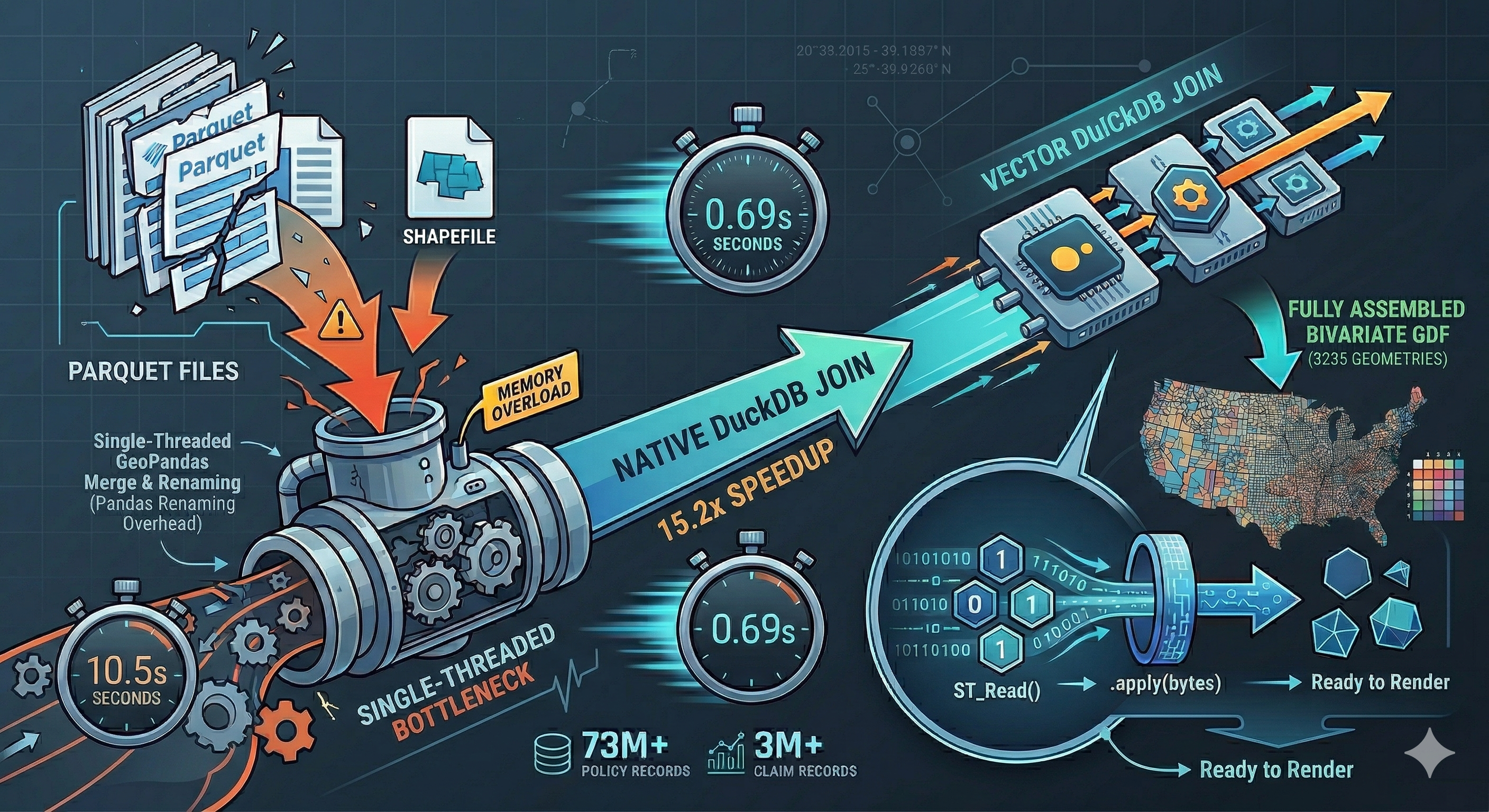
How switching to DuckDB’s spatial extension cut execution time from 10.5s to 0.69s on large FEMA NFIP datasets. Read more
Projects
The Deval in the Details Report
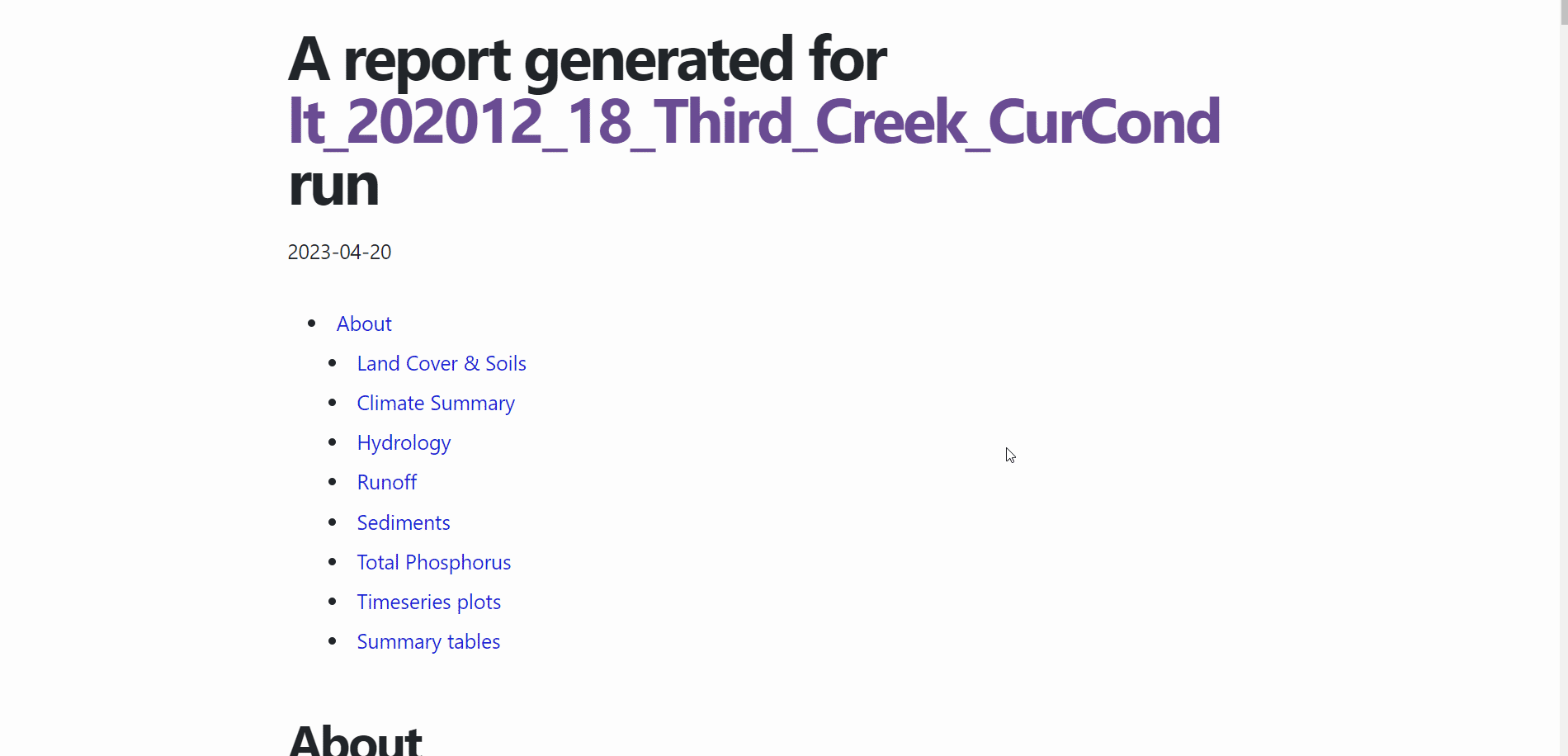
This is an automated data analytics tool designed to enhance the user experience for WEPPcloud users. It generates comprehensive run reports that include detailed and interactive graphical outputs and tabulated summaries of the WEPPcloud watershed run results. These reports can be easily downloaded and utilized for various purposes such as reports, presentations, or any other information needs. Read more
Publications
A Proposed Methodological Framework to Estimate the Utility of EO-based Information in Data Scarce Contexts: Challenges and Recommendations
The growing imperative for resilience to extreme events has elevated the role of Earth Observation (EO) technologies in supporting global water resources management and disaster preparedness. Building on a growing body of work to assess the value of EO information in different contexts, we propose a methodological framework to maximize the expected utility of streamflow information in data scarce environments. GEOGLOWS, an EO-based hydrological forecasting initiative, has successfully demonstrated its use in Ecuador through partnerships with local institutions. Its Hydroviewer provides crucial streamflow predictions with sufficient lead time, enabling early action to mitigate flood and drought risks. To complement qualitative information, economic models can be designed to quantify the expected value to individuals, provinces, or other unit-areas,, however systemic data limitations may challenge efforts to fully estimate such utility. This perspective paper proposes a detailed framework to apply a standard economic impact evaluation framework, and it uses the application of GEOGLOWS in Ecuador as a case study. This approach highlights the need for targeted data collection strategies, specifically, on damages, averted losses, and system usage metrics, alongside frequently updated socioeconomic information. Such data are crucial to enable robust economic impact assessments and to inform future investments in EO-driven water management solutions, especially in resource-constrained environments. Read more
Talks
Historical Increase of Urban Wastewater Availability Impacts on River Basin Hydrology and Agricultural Development
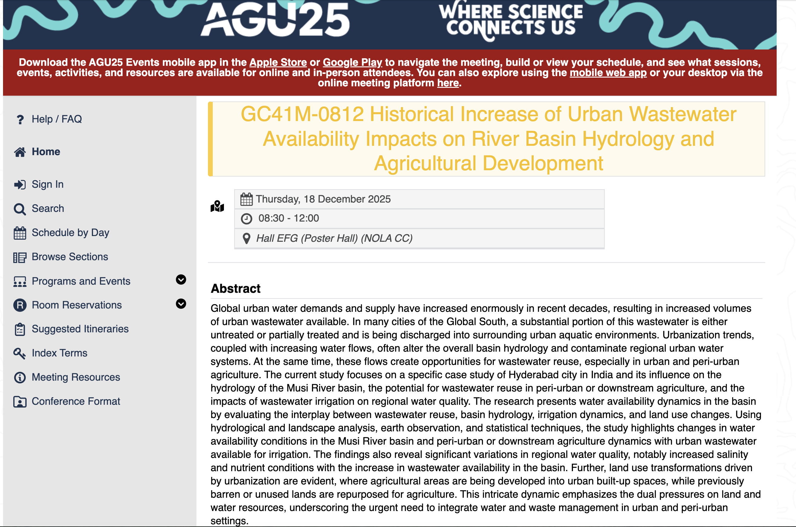
Global urban water demands and supply have increased enormously in recent decades, resulting in increased volumes of urban wastewater available. In many cities of the Global South, a substantial portion of this wastewater is either untreated or partially treated and is being discharged into surrounding urban aquatic environments. Urbanization trends, coupled with increasing water flows, often alter the overall basin hydrology and contaminate regional urban water systems. At the same time, these flows create opportunities for wastewater reuse, especially in urban and peri-urban agriculture. The current study focuses on a specific case study of Hyderabad city in India and its influence on the hydrology of the Musi River basin, the potential for wastewater reuse in peri-urban or downstream agriculture, and the impacts of wastewater irrigation on regional water quality. The research presents water availability dynamics in the basin by evaluating the interplay between wastewater reuse, basin hydrology, irrigation dynamics, and land use changes. Using hydrological and landscape analysis, earth observation, and statistical techniques, the study highlights changes in water availability conditions in the Musi River basin and peri-urban or downstream agriculture dynamics with urban wastewater available for irrigation. The findings also reveal significant variations in regional water quality, notably increased salinity and nutrient conditions with the increase in wastewater availability in the basin. Further, land use transformations driven by urbanization are evident, where agricultural areas are being developed into urban built-up spaces, while previously barren or unused lands are repurposed for agriculture. This intricate dynamic emphasizes the dual pressures on land and water resources, underscoring the urgent need to integrate water and waste management in urban and peri-urban settings. Read more
Featured categories
R (9) Shiny (6) package (3)Curious about all intersections of water, data and society.